‘Watching the world go by at Wingecarribee’

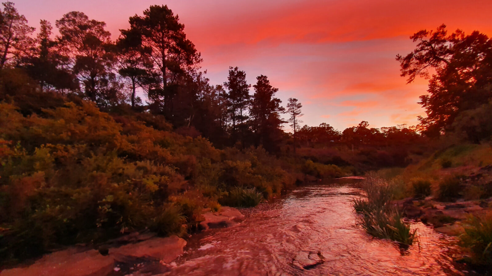
“A flight of birds” or “waters to rest beside” – take your pick – either description is appropriate for Wingecarribee Shire, south-west of Sydney. To be sure, there are birds – most notably noisy parrots – but that’s always going to be the case where there’s water. The latter option of resting is one I like, because I’ve spent many hours beside this river, most recently on the Stone Cutters Walk shooting a sunset.
On a list of well-known rivers in Australia, Wingecarribee River would not be visible anywhere near the top. It’s a name that is rarely heard outside of its territory and, truth be known, it’s not large in terms of volume. What it has is patches of prettiness, some reservoirs and lots of history. Indeed, it’s the lifeblood of the Southern Highlands and part of the Hawkesbury-Nepean river system, though it starts just a couple of kilometres from the head of the Nepean but drains in a different direction, becoming part of the Wollondilly before it eventually unites with the Hawkesbury-Nepean system.
I’m in the historic village of Berrima, about a kilometre downstream from where I shot yesterday’s sunset and, amid riparian vegetation, watching a dozen dragon lizards and skinks scurry around the colourful sandstone mottled with lichen. The fact the light is so different goes without saying, such are the vagaries of the weather and the angles of the sun.
Today, though, I was here for the fog. Crowds of droplets hanging in the atmosphere lend an aura to rivers that’s deeply moving, as the gentle zephyrs of the dawn move the mist almost imperceptibly, drifting through the riverside trees – at times obscuring, at others revealing. I’ve stopped momentarily to get some quick snaps before the fog rises, just in case I don’t get to my destination (Goanna Falls) before the damp air disappears.
By chance, I’m at the section where there was a German internment camp during and just after WWI. Judging by the pictures on display boards, life could have been worse. I’m always disheartened by how quickly a nation can turn on its citizens because of their origin. Racism has a way of surfacing when it gets the chance. As a balance, I have to bear in mind that two Turks shot up a tourist train at Broken Hill during the same conflict, so there’s a whole raft of arguments there.
By all accounts though, it was reasonably harmonious here and the locals were all invited to the site when they opened a 105-metre-long bridge that gave access to the far side. The Germans, a lot of them seamen, were interred at night at the local jail but had freedom during the day and they built huts by the river, as well as boats. The whole scene used to attract crowds of thousands on weekends.
I got some shots and headed off to the fancifully named Goanna Falls. I say fancifully because it’s barely a creek and the drop wouldn’t even be two metres! Still, the light is good for photography, so it’s not a complete waste of time. The fact that either side is a swamp is interesting because, right up in the headwaters of the Wingecarribee is a significant swamp.
Here was a wetland of natural significance, but in less-enlightened times (1967) the government allowed peat mining here. Apparently it’s used as a growing medium but unfortunately it also takes away a natural bounty. After the 25-year mining lease expired, mining continued, despite much opposition, especially from the Sydney Water Corporation and the National Parks and Wildlife Service, driven by the National Heritage Council.
In 1997, the mining warden gave mining the green light again. However, such was the opposition that next year a temporary Conservation Order was placed on the site. Despite this, the minister for Mineral Resources okayed mining again. Tragically, heavy rains soon after caught the dredge and dragged it along through the swamp creating a channel, ripping the head and draining the swamp through to the reservoir. It was estimated it would take at least 20 years to recover, which is about now. It’s doubtful anyone will be applying for another mining lease soon!
In the afternoon, I visited the Cecil Hoskins Nature Reserve. Here, the waters of the Wingecarribee are backed up by the Bong Bong Weir that was built to supply water to Moss Vale in the 1920s. The wildlife reserve (created in 1932) is named after an avid botanist and conservationist who contributed some personal finance towards purchasing the area. Amazingly, during the drought in the 1960s, the Wingecarribee Council wanted it destroyed so a local concrete factory could be supplied with water. The outcry that followed thankfully quashed that idea. In 1975 it was gazetted at a higher governmental level, so hopefully it’s here for eternity.

More than 90 bird species have been recorded, including some rare waterbirds and even the elusive platypus and it’s also a great place for a picnic, with toilets and tables provided. Not far away, on the opposite side of the Bowral-Moss Vale road, there’s traces of the original route that opened up the south and existed for 45 years. Called the Old Argyle Road, there’s now an excellent bike/walking path that follows the old route for a short while, past the now disused Bong Bong Cemetery. It leaves Moss Vale and gets to Bowral on the rear side of some glorious real estate in Burradoo – just the place for some morning exercise.
The Wingecarribee has shaped and been shaped by civilisation in the Southern Highlands, yet it still retains some vestiges of its original look. It’s never far away and worthy of chasing down for a tranquil natural experience.


 Proudly Australian owned and operated