‘When wander becomes wonder: The lost world of Bomaderry Creek near Nowra’

Slap. I was losing count. I wished there was someone else here so I could share the burden. The rains bring plagues and, apart from the mice, mosquitoes were in the ascendancy. Slap! Another bloody spot, it was time to move again.
Just where I should go I wasn’t quite sure. I’d been tipped off by two people that there might be some photo opportunities in the Bomaderry Creek area (near Nowra, New South Wales). Research indicated more than one trail wandering around the creek, seemingly covering all directions. Creeks are usually good value when it comes to photography, so I had some expectations.
It was less than half a kilometre away as the crow flies, so I imagined it couldn’t be all that great. I mean, just a few hundred metres from the Princes Highway and near a populous area, it would be publicised, right? However, mentions were few and the parking area held, at its maximum capacity, about six cars, at a pinch that is. There were two on the day I visited in the middle of school holidays.
The whole thing had been kicked off by the Rotary Club who were eventually granted approval in 1979 to make a trail following animal tracks.
I’d ridden the bike over, hoping to maybe do a fair amount of the trail, or trails, on two wheels and thus save my knees. However, after about 300m, the level bits stopped and a stairway descended between two large sandstone outcrops. Time to abandon two wheels.
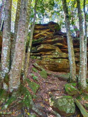
Immediately possibilities began to crop up. The sandstone was of significant size and the creek was rushing below somewhere if the sound was any guide. I went down and, then, all the way to the creek. Upstream was an abandoned weir, originally built in 1938 as a water supply. When no longer needed, part of it was removed in 1998 to allow the fish to head further upstream for spawning.
I returned to the steps and ventured a few hundred metres before calling it quits. There were hints of promise, but when I returned it would be on the other side.
Falcons Crescent Link Trail was the new venue. After about 20 minutes on the bike to circumnavigate the lower reaches the other side was obtained and I was immediately uncertain as to which trail exactly to follow so, as you do, I asked a man walking a dog. He immediately expressed regret that he’d sold his bike as he eyed mine off. Used to enjoy riding the trails and was familiar with them all. Apparently the bush was riddled with mountain bike tracks.
The man no longer rode them. At some stage he’d torn the tendons at the rear of both feet and they were causing him the kind of grief I could only wince at.
I found what I thought was the trail he indicated but, it actually ran more or less parallel to it until I crossed over and, suddenly, there was the main trail on the western side of the creek. The intersection was but 100m from the modern bridge from yesterday and I was there in a minute or two. At the start of the bridge I scaled the railing and dropped to the river bank.
Here, apart from the mosquitoes, the sandstone walls looked more dramatic, the creek more enticing and the original track was still visible; there was even an aluminium plaque from yesteryear. It indicated that once this had been the creek crossing, in days before occupational health and safety, when you could rock hop across the river, this was the way to go. The now vandalised sign recommended stopping here and soaking up the sounds of the bush, in particular the white-throated tree creeper and the spotted pardalote.
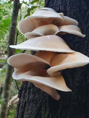
I clambered all the way back up to the bike and queried another walker as to where Palm Lookout was. Apparently it was only 25m away, but hidden by a shrub. While the view was good, the drama of the cliffs was somewhat lost in the vegetation. I quit for another day, riding back through the scribbly gum, red bloodwood forest and the hairpin banksia, all common, unlike the Bomaderry zieria that exists nowhere else on earth except both sides of the creek. There are remnants of bushfires, 20 in 20 years, mostly through arson, but regrowth is strong and fresh shoots tend to dominate.
At the third attempt I determined to head upstream on the eastern side, Bernie’s Lookout the destination, though just who Bernie was I have failed to ascertain. So I returned to the Narang Road entrance and headed upstream, noting that the sandstone wasn’t as deep here, but access was easier and there were many photos to be had. The trail indicates it’s to Bernie’s Lookout so I rode off, noting that the trail is bitumen, though very narrow.
The gorge up here isn’t as deep, but pleasant and photogenic nonetheless. There are no signs as to where the lookout actually is. Alone in this wilderness, it is apparent that few bother coming up here and I surmised that when I ventured south on another day there wouldn’t be much more to see.


 Proudly Australian owned and operated