It’s early April, sunny, and around 25 degrees as I turn off the Princess Highway a few kilometres north of Bega and onto the B72 – the Snowy Mountains Highway. I’m going to travel its entire length over the next 10 days in my Toyota campervan. I’m a slow traveller.
Once on the Snowy Mountains Highway, I find myself in the most picturesque valley imaginable – the Bega valley. Here, one could so easily imagine oneself in the gentle and verdant valleys of Scotland or Wales, but for the small village named Numbugga (pop 307) only 15km into my journey. It’s off to my right. I’m always fascinated by those uniquely Australian-named towns and I’m already pondering the origins of Numbugga with its 307 Numbuggas.
The picturesque valley continues as I pass through Bemboka and on to the foot of the Brown Mountain pass whereupon the road climbs steeply through thick temperate forests to the small village of Nimmitabel, 1,075m above sea level. Here, the contrast in vegetation, terrain and temperature is extreme. The temperature has dropped 10 degrees, the thick forest has been replaced with open and undulating sheep-grazing fields and the many deciduous trees are in various stages of transformation into their gold, red or orange colours. It’s another, beautiful world.
Nimmitabel (pop 240) is where the classic 1960 Australian movie The Sundowners was made and where the cast, featuring Deborah Kerr, Robert Mitchum, Peter Ustinov and Chips Rafferty, stayed during production – at the Royal Hotel. Nowadays, most people under 60 probably won’t know of this epic film and many will most likely think Chips Rafferty to be an exotic potato dish from My Kitchen Rules. I decide to spend the night in Nimmitabel, determined to brave the cold night that I feel descending prematurely. Fortunately it only drops to four degrees, which isn’t so bad after all.
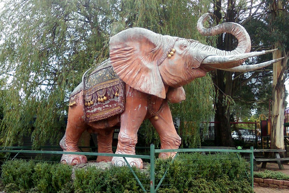
I’m off early next morning straining through a thick fog heading for Cooma. It’s slow going as I firstly drive down Nimmitabel’s deserted main street. I can barely see. Suddenly I am startled by the sight of a huge life-sized pink elephant through the fog. I screech to a halt thinking to avoid colliding with it only to discover it’s a manmade replica in a roadside park. “Why?” I ask myself.
To add further confusion in my cold and foggy world, the Snowy Mountains Highway has suddenly become the Monaro Highway. Where did it go? I eventually realise both highways share the same road between here and Cooma. Early foggy mornings are a real challenge for me.
As I drive into Cooma, the fog is lifting and I have little knowledge of what lies between both towns other than what a tourist brochure is telling me: I will see a vast and mysterious, treeless plain – the Monaro.
I’m so impressed by the glorious autumn weather, the autumn colours and the old-world charm of Cooma that I spend two nights a few kilometres out of town in a free campsite in the good company of other fellow grey nomad-types. We all agree this is the best place to be in Australia at this time of year.
Read more: Five miles from Gundagai
In Cooma I find the Snowy Mountains Highway once again and set off for the new township of Adaminaby. The old Adaminaby was submerged in nearby Lake Eucumbene decades ago as planned by the Snowy Mountains Hydro-Electricity Scheme. From Cooma onwards the traffic becomes noticeably light. I begin to wonder why is this so in such a picturesque and easily accessible region so close to the major population centres of Sydney, Melbourne and Canberra.
The road slowly rises once again through Adaminaby and higher still to Kiandra at around 1,500m. All that remains of Kiandra is an old police building that has been converted into a lodge. Kiandra was once a thriving gold-mining community of around 15,000. The last resident left in 1974. It’s claimed Kiandra is the birthplace of Australian skiing as miners would slide down the long, treeless slopes on planks of wood. The miners must have been a hardy bunch as the July temperatures average 3.9 degrees maximum and -3.2 minimum. January’s averages are 20.7 degrees maximum and 6.1 minimum. I open my window to test the April air and quickly close it again.
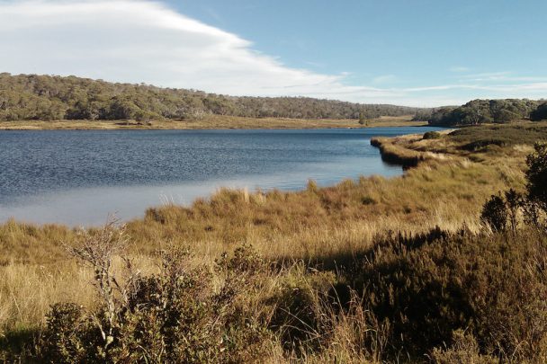
I turn off the Snowy Mountains Highway at Kiandra and make a three-mile detour to the Three Mile Dam campsite several hundred metres higher in altitude. The dam and its picturesque campsite captivate me and, call me foolhardy if you must, I dare myself to spend the night. There are a few other hardy, well-rugged-up campers here too. I park my van in the full sun for warmth and spend the next three days here painting, reading, walking, keeping warm and doing my washing in the frigid lake. Nowadays some scientists are talking about the possible existence of parallel universes or realities… here I feel I am immersed in one.
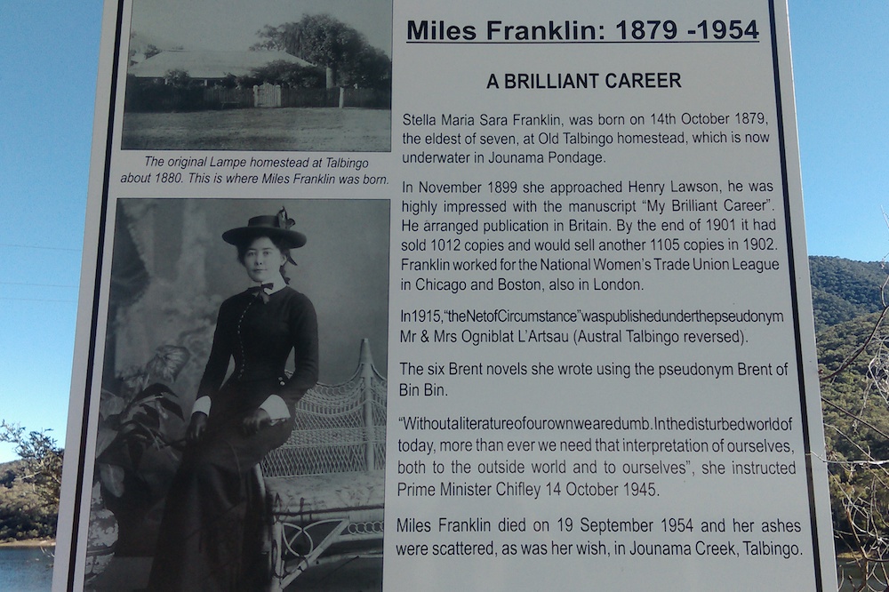
After my second night of -2 degrees I decide I’ve earned my boy scouts endurance stripes and drive on down from around 2,000m to the lower and milder altitudes to the also-new township of Talbingo – home of Australia’s literary giant, Stella Maria Sarah Franklin, also known as Miles Franklin. Stella Franklin is the author of 21 books reflecting her belief in equality and social justice for women. You may remember her from the Australian film, My Brilliant Career – my favourite Australian movie. A centrepiece of this peaceful village is the Miles Franklin Memorial Park located upon the foreshore of the Talbingo reservoir.
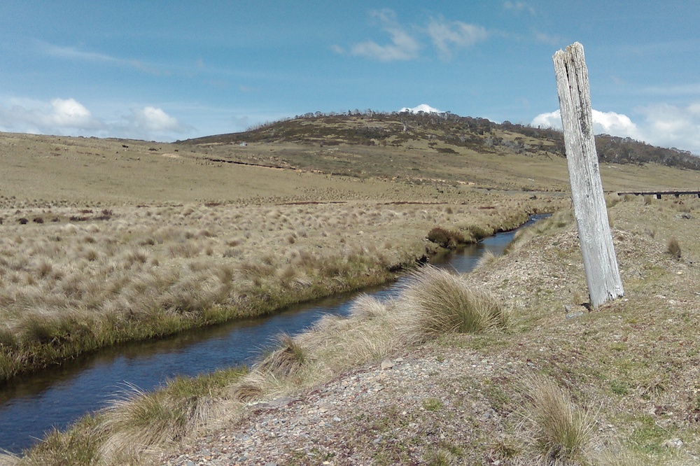
A few kilometres from Talbingo is the huge Tumut 3 Power Station – well worth a visit. Also very close-by is the crystal clear Journama Creek where Stella Franklin was born and spent much of her life. It’s where her ashes were scattered. It also has a peaceful campsite where I spend the next few days doing my usual daily camping activities.
If any readers are thinking that such a journey along the Snowy Mountains Highway requires a caravan, campervan or tent, don’t feel left out as all the aforementioned towns and villages are well-serviced by hotels, motels, cabin parks, excellent phone coverage, TV reception, fuel supplies and more. The road is high quality, the traffic is light and there are also well-placed scenic lookouts. There is much more to the Snowy Mountains Highway than I have attempted to write about here.
Moving on from Talbingo I follow the Snowy Mountains Highway alongside the Blowering Reservoir for almost 20km. Along this section there are numerous well-appointed free campsites where you will see caravans, tents and day visitors enjoying the enormous waterway and its magnificent foreshore.
Read more: To caravan or not to caravan?
The weather is once again warm and I spend three nights here on the foreshore with so much room to myself I almost begin to feel lonely before moving on to Tumut. Tumut is an historical town wedged between the Snowy Mountains with gently rolling hills dotted with grazing sheep.
From Tumut, the Snowy Mountains Highway (B72) now passes through sheep and wheat farms, through Adelong until finally the roar of traffic warns me that the highway is about to terminate at the busy M31 – the Hume Highway.
Herein I have simply presented my experiences and interpenetration of the Snowy Mountains Highway – a highway that traverses warm and humid valleys, temperate forests, treeless plains, alpine regions, historical sites and so much more in such a comparatively short distance. I’m now left wondering where else in Australia could I find so much diversity packed into such a short journey that is so accessible.
See you out there!
Caution: Snow chains are required to be carried during winter months. Check ahead.
Read more stories from Garry at his Travel at 60 author profile.


![]()
 Proudly Australian owned and operated