Tracking Tropical Cyclone Alfred: Starts at 60’s live coverage and latest alerts

Welcome to Starts at 60’s rolling coverage of Tropical Cyclone Alfred.
Start at 60 will be providing continuous coverage of Tropical Cyclone Alfred as it makes its presence known along the Queensland and New South Wales coasts.
Our updates will include the latest developments, official warnings, and practical advice to help keep you informed and safe as the storm progresses.
Important reminders:
- For updates in the event of a power outage: tune your radio to 612AM ABC Radio Brisbane
- Ensure you have the number for State Emergency Services written down: 132 500. This is the number to call for non-life-threatening flood and storm emergency assistance. If the situation is life threatening, always call 000.
- For essential advice on how to prepare, please visit the Queensland Government’s Disaster Management page.
- For the latest tropical cyclone advice from the Bureau of Meteorology, click here.
Sunday, March 9, 12.00 pm
Heavy rain and floods keep Queensland and NSW on edge after Alfred’s downgrade
Ex-tropical cyclone Alfred continues to wreak havoc across Queensland and New South Wales, with torrential rain and flooding still posing significant risks and more than 300,000 homes without power.
Alfred, which transitioned from a tropical cyclone to a tropical low, began moving from Queensland’s Bribie Island inland towards the state’s southwest on Sunday, March 9. However, the danger is far from over, as heavy rain and floodwaters continue to cause widespread disruptions.
According to the Bureau of Meteorology, residents of southeast Queensland and northern New South Wales should prepare for further rainfall, with forecasts predicting up to 700mm of rain in some areas.
Destructive gusts and persistent downpours are expected to continue through Monday, March 10 particularly in already affected regions.
Senior meteorologist Dean Narramore explained that flash flooding remains a major concern, with swollen rivers throughout the region.
“Today is all about the rainfall that’s likely to be experienced around southeast Queensland and far northeastern NSW,” Narramore said.
Isolated rainfalls of up to 400mm are expected on Sunday alone with another trough from Central Australia dragging the weather activity inland over northern NSW.
“By Wednesday, the weather system will finally shift all this wet weather to coastal parts of NSW and clearing mid to late week while southeast Queensland should start to see conditions easing from persistent rainfall on Monday,” Narramore added.
The Wyaralong Dam, an hour south-west of Brisbane, has started overflowing due to heavy rain.
In NSW, multiple flood warnings remain in effect for the Tweed, Richmond, Wilsons, Clarence and Bellinger rivers.
More than 45 people have been rescued so far in the latest flood event.
Around 15,000 people throughout NSW are still under 36 emergency warnings, with NSW North Coast Minister Rose Jackson noting 800 have sought shelter in the state’s 21 evacuation centres on Sunday.
Despite the ongoing challenges in southeast Queensland, there are signs of things slowly returning to normal, even though power outages are still affecting residents with 100,000 losing electricity overnight.
Supermarket giant Woolworths said some of its stores are reopening and shelves are being restocked.
Public transport, excluding trains and Gold Coast buses, is resuming while shops, supermarkets and service stations will begin opening on a case-by-case basis.
-with AAP.
Saturday, March 8 10:00 am
Cyclone Alfred downgraded, but danger still remains for millions of Australians
Millions of Australians have been urged to remain vigilant as ex-tropical cyclone Alfred crosses onto the mainland, with the worst of the heavy rain and flash flooding still expected to come.
Despite being downgraded to a tropical low on Saturday morning, severe weather warnings are still in effect for much of southeast Queensland and northern New South Wales.
While no deaths or widespread property inundation have been reported in Queensland, a man remains missing after being swept away by floodwaters in Megan, near Coffs Harbour. Thousands of people are still under evacuation orders as authorities work to manage the ongoing threat.
Prime Minister Anthony Albanese stressed that while communities are “well prepared,” the danger has not passed.
“It is important that people do not take this downgrading as a reason for complacency,” Albanese told reporters in Canberra.
“Its impact will be serious and will intensify over coming hours and indeed over coming days.”
Queensland Premier David Crisafulli also cautioned that we’re not out of the woods just yet.
“The challenge is now flash flooding, creek rises – they remain a real prospect predicted in days ahead,” Crisafulli told reporters.
“We have to be ready for that prospect and with already swollen catchments, the risk of flash flooding remains.”
As of Saturday morning, more than 280,000 homes and businesses in Queensland and New South Wales have lost power, and telecommunications have been affected across both states. The Gold Coast Council has urged residents to stay inside due to widespread flooding and significant damage across the city. Schools and public transport in southeast Queensland remain closed until further notice.
Severe conditions continued to batter coastal communities overnight, with 120 millimetres of rain recorded at the Gold Coast and 130 millimetres at Lismore since 9 am on Friday.
There were some 8800 calls for assistance to the SES in northern NSW and 31,400 dwellings under flood warnings as of 5 am on Saturday.
There have been 30 flood rescues, mainly people driving through flood waters, and the agency said more than 16,000 people were under evacuation orders in the Northern Rivers and Mid North Coast areas.
To support local authorities, around 180 Australian Defence Force personnel are on the ground in both states, with more on standby.
-with AAP.
Friday, March 7 11:00 am
Thousands left in the dark as Tropical Cyclone Alfred closes in
As Tropical Cyclone Alfred approaches landfall, tens of thousands of homes are already without power and in urgent need of assistance.
Wild winds and heavy rain are expected to intensify on Friday, March 7, before the cyclone makes landfall later in the evening or early Saturday, March 8, likely between Noosa and Coolangatta in Queensland.
The category two system was about 180 kilometres off the Gold Coast early on Friday and the Bureau of Meteorology says it’s likely to remain at that intensity as it makes landfall.
The impact of the cyclone is exprected to extend hundreds of kilometers, from Double Island Point in Queensland to Grafton in New South Wales.
More than 28,000 homes and businesses in southeast Queensland lost power on Friday morning, including areas around the Gold Coast, Redland City, and Scenic Rim.
Power company Energex attributed the outages to debris affecting powerlines and substations and warned that some outages could last a week or more.
‘While we hope this doesn’t happen, we must be ready for serious damage to the power network and/or homes,” the company said.
As of Friday morning, the SES had received approximately 6,300 requests for assistance from NSW’s Northern Rivers and Mid North Coast regions, with many residents spending their first night away from home after being evacuated.’
-with AAP.
Friday, March 7 9:30 am
The calm before the storm
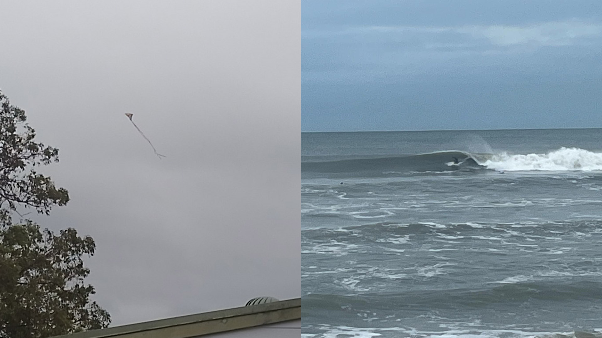
As South-East Queensland awaits more news of Tropical Cyclone Alfred, some opportunistic locals are taking advantage of the windy conditions with kite flying in Redbank and surfing on the Sunshine Coast.
Thursday, March 6 5:05 pm
All flights in an out of Brisbane have been suspended
Brisbane Airport has advised that all inbound and outbound passenger flights have been suspended until further. Operations will resume “as it is safe to do so, when the weather system has passed and when the Airport’s terminals and runways are deemed safe to re-open”.
The airport has has advised passengers not to come in until specifically requested by the airline.
If you have an upcoming flight, you will be contacted by your airline. Most airlines have extended the opportunity to change and update flights. For more information on next steps, please visit the Brisbane Airport website.
Thursday, March 6 11:00 am
New South Wales Premier Chris Minns urges residents to shelter in place
As communities brace for the impact of Cyclone Alfred, New South Wales Premier Chris Minns has urged residents to stay put.
The State Emergency Service has issued a warning for all residents to remain indoors including in Lismore and Byron Bay, which were severely impacted by record floods three years ago.
Around a dozen prepare to evacuate orders have been issued including for Ballina, Belongil and Kyogle.
Highlighting the severity of the situation, Minns has traveled to Lismore to thank the approximately 2,000 SES volunteers stationed in the region.
“Stay out of flood waters, stay at home during the peak of the storm – make good decisions,” he said on Thursday, March 6
“We hope for the best, but we’re prepared for the worst.”
The category two cyclone is expected to bring heavy rain and strong winds, with conditions likely to peak on Thursday night and Friday morning.
Gales with damaging wind gusts up to 120 km/h are expected to hit island communities between Double Island Point and Grafton on Thursday and continue on Friday.
Cape Byron, the easternmost point of mainland Australia, will be in the eye of the storm with dangerous storm tides and destructive winds of up to 155 km/h predicted.
Abnormally high tides and damaging surf conditions along the northern coast have also been recorded with warnings issued to avoid beaches.
The Bureau of Meteorology has warned of possible major flooding in Thora and Bellingen in the coming days.
Flights to Ballina have been canceled due to high winds.
-with AAP.
Wednesday, March 4 8:00pm
Brisbane City turns into a ghost town as Tropical Cyclone Alfred approaches
Empty shelves, sandbagged windows and vacant streets are among the eerie sights of the once bustling district.
@corporatecatwalker Brisbane City ghost town ahead of cyclone Alfred #cyclonealfred #brisbane #district4000 ♬ The Hanging Tree – James Newton Howard
Wednesday, March 4 9:00 am
Panic buying in Brisbane as Tropical Cyclone Alfred approaches
From toilet paper to almond milk, stock is flying off the shelves.


 Proudly Australian owned and operated
Comments 0
Join the conversation. Comments are reviewed before they appear.
Be the first to comment.
Join the conversation
Tell us who you are to post a comment. We'll remember you next time.